![]() May-June 2001
May-June 2001
Outdoor Smarts
GPS: Where on Earth are you?
By Karen Berger
Photographs by John R. Fulton Jr.
Global positioning systems are nifty navigational gadgets, but they are not a substitute for good map and compass skills.
- Read previous "Outdoor Smarts" coulmns:
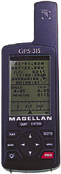 The Magellan 315 ($150) stores up to 500 waypoints/landmarks and features a resettable trip odometer. |
Remember how Hansel and Gretel tried not to get lost on their walk in the woods? They dropped bread crumbs along the trail so they could find their way home.
Today, with a handheld global positioning system (GPS), you can do the same with electronic bread crumbs, called waypoints, and not worry about forest animals gobbling them up.
Ever since global positioning systems became available to consumers, they've gotten smaller, lighter, less expensive, and more accurate. A GPS unit designed for backpacking fits in a pocket, weighs only a few ounces, costs between $150 and $350, and can pinpoint your location to within a few feet. Its job is to help you get from Point A to Point B.
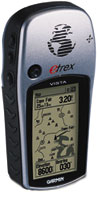 The eTrex Vista ($375) boasts a 24MB memory capacity and accepts downloads from Garmin's MapSource CD-ROMS. |
Some basics
Global positioning systems are a product of American military technology. By receiving and interpreting signals from satellites, they use coordinates to determine location.
Early GPSs were imprecise because of a built-in distortion: Satellites were programmed to send "degraded" information to nonmilitary units. A consumer-model GPS could put you within a football field of a spring, but it couldn't bring you to the spring itself.
Former President Clinton authorized the removal of the intentional distortion. Now GPS receivers are accurate to within a couple of feet, meaning that they'll help you find a spring, a campsite, or the location of an injured hiker.
How GPSs work
The data a GPS unit collects from satellites is presented as a set of coordinates, most commonly as either "lat-long" (latitude and longitude) or as UTM (Universal Transverse Mercator).
It sounds complicated, but both systems work on the same principle as the x and y axis grids you learned in basic algebra.
While most of us are more familiar with latitude and longitude, the UTM system is actually easier to use because the data can be more easily interpreted in terms of kilometers (or even meters).
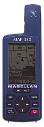 The Map 330 ($250) utilizes Magellan's MapSend Streets CD-ROM for comprehensive North America navigation. |
What GPS can do
Simply put, a GPS takes a reading of where you are; then you enter the coordinates of where you want to go, and the device tells you which way to walk.
In practice, it rarely works quite that easily. Trails meander, and the direct way is not always the right way.
Imagine, for instance, that you are on one side of a mountain and you want to get to the other side. The GPS unit would take the most direct route, sending you in a straight line right over the summit. Sometimes, the quickest way from Point A to Point B is not a straight line.
This problem is easily fixed with a bit of planning: Before you start your hike, you can enter intermediate coordinates, called waypoints, into the GPS. The more waypoints you enter, the more accurately the GPS will calculate the direction you have to walk and the distance you have yet to travel.
GPS can also help you find your way back to a place you have been before. Say you are at a campsite and want to ramble cross-country. Before leaving the campsite, you would take a reading and save the coordinates. Now, you can wander wherever you like. When you are ready to return to camp, the GPS will determine where you are and calculate in which direction (and how far) you have to walk to get back.
GPS is especially useful in situations where field navigation is difficult or visibility is low. In snow or thick fog, compass navigation from point to point is a tedious, difficult process because of the lack of visual targets.
With GPS, you don't need visual targets: You just enter the coordinates of your destination, and the GPS will tell you which way to go. If you veer off in the wrong direction, the GPS will pick up that information and tell you how to correct your course.
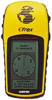 Garmin's eTrex ($120) features an electronic compass and lets you retrace your path in both directions. |
Similarly, a GPS can tell you where you are when you find yourself disoriented in rolling terrain where each ridge looks basically the same and there are few distinct landmarks.
Where GPS really excels is as an emergency tool. Whether you call for help with a cell phone or hike out for help, a GPS enables you to tell rescuers precisely where help is needed. Instead of getting directions like "You know that lake over by Muddy Pass; there's that old game trail that wanders down the canyon...," rescuers get precise coordinates, enabling them to save time on the "search" part of search and rescue.
Finally, GPS is a great gadget for teaching Scouts backcountry navigation skills. Using a GPS to plot routes, identify places on the map, and download information about trips already taken are all activities that can sharpen old-fashioned map and compass skills.
What GPS can't do
All that said, GPS is not a substitute for knowing how to use map and compass.
There's always Murphy's Law to consider. GPSs sold for backpacking are rugged and hardy, but they are still pieces of delicate electronic equipment. If you fall, they can be smashed. If you slip during a river ford, they can be lost in the water. And in cold weather, batteries can go on strike.
A couple of tips: Lithium batteries last longer. Always carry extras. In cold weather, keep them close to your body; warm batteries last longer than cold batteries.
And remember: Even with a perfectly functioning GPS, you've still got to be able to decipher contour lines and tell whether they form ridges or canyons, cliffs or plateaus. The GPS can point you in the right direction, but it's the map that tells you if it's possible to go that way.
The bottom line on GPS: It's a tool that can increase your backcountry safety and enjoyment—but like all tools, its use depends on the skills of the user.
Karen Berger writes about hiking and backpacking for http://www.gorp.com, an online resource for outdoor recreation. She is also the author of eight books, most recently, Hiking the Triple Crown (The Mountaineers Books).
May-June 2001 Table of Contents
Copyright © 2001 by the Boy Scouts of America. All rights thereunder reserved; anything appearing in Scouting magazine or on its Web site may not be reprinted either wholly or in part without written permission. Because of freedom given authors, opinions may not reflect official concurrence.
| The Boy Scouts of America | http://www.scouting.org |